 Introduction to WATFLOODOverview of WATFLOODWATFLOOD is an integrated set of computer programs to forecast flood flows for watershed having response times ranging from one hour to several weeks. Continuous simulation can be carried out by chaining up to 36 events. A shell program organizes all the menus used for data input and correction functions and acts as the manager for the hydrologic model SIMPLE and utility programs. The emphasis of the WATFLOOD system is on making optimal use of remotely sensed data. Radar rainfall data, LANDSAT or SPOT land use and/or land cover data can thus be directly incorporated in the hydrologic modeling. CHARM uses the Grouped Response Unit (GRU) method to model large watersheds. This concept was first developed and tested in CHARM. The GRU is a technique that is designed to greatly improve the computational efficiency for modelling large watersheds. This approach allows a 5 month simulation of the 50,000 sq. km study area of the Columbia River in British Columbia to be modeled with approximately 3200 separate response units at 1 hour time intervals in 4 - 7 minutes on a 90 Mhz Pentium computer or a SUN SPARC 20 workstation. It is well known that the hydrological response from such land covers as, for instance, forests and alpine tundra, differ greatly but it can be expected that for example, two or more similarly forested areas that experience the same meteorological conditions would have the same response. The same logic applies to other land covers. In the GRU method, all similarly vegetated areas (not necessarily contiguous) within a sub-watershed or element are grouped as one response unit and called a GRU. The GRU is the basic computational unit in the model. An element has one GRU for each hydrologically significant land cover type. The hydrological response from all GRUs in an element are summed to give its total response. The size of each GRU (or area of each type of land cover) in each element is determined from LANDSAT or NOAA imagery. Each pixel in the image is georeferenced and classified into one of the pertinent hydrologic response groups, for instance: dense forest, light forest, crops, barren land, urban areas, wetland and glacier. A group of pixels in a grid having the same spectral properties, indicating a particular land cover class, is referred to as a GRU. The pixels do not have to be contiguous. The number of pixels in each class are then used to determine the percent cover of each hydrologically significant class in each sub-watershed or grid. The hydrologic response of each class is computed as if that class covered the whole grid but its response (flow) is weighted according to its percent coverage in that grid or sub- watershed.
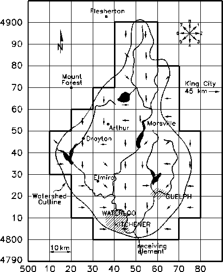
Figure showing Grand River basin divided into GRUs (13K) The modelling parameters are tied to the land cover type and as such should apply to other watersheds where the land cover mix may be different, but where similarly vegetated areas can be expected to respond in the same way to meteorological conditions. The system is completely modular but has a consistent data structure throughout. It has been under continuous development since 1972. Several Master's and Ph.D. research programs have provided the rationale incorporated in the software, but programs have all been written or adapted to WATFLOOD by N. Kouwen. |
![]()
Watflood for Windows
© copyright 1999-2000 Civil Engineering, University of
Waterloo